The Dig
A look at the excavation behind PalaeoPixels
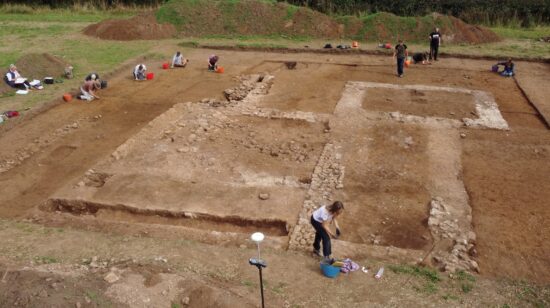
DigVentures was part of a team archaeologists, geologists, and climate scientists from five different universities which excavated a former gravel quarry near Swindon looking for evidence of early hominids.
In 2017, two local fossil collectors, Nev and Sally Hollingworth, had spotted a Neanderthal handaxe along with several mammoth fossils while visiting the former quarry. This discovery sparked two seasons of careful excavation, and a whole heap of exciting discoveries.
The excavations revealed that a mammoth graveyard lay buried within the shoreline of an ancient river, which once flowed through the site over 200,000 years ago.
The excavations also revealed that these mammoths had lived and died during a period of dramatic climate change when Britain was still occupied by Neanderthals. But as temperatures began to plummet, the species shrank in size and the Neanderthals were forced to move away.
Evidence collected from the site, including stone tools, megafaunal remains and palaeoenvironmental samples containing snail shells, seeds, and insects, gave us a snapshot of this ancient habitat.
While we continue to analyse the results of the excavation, we hope to provide answers to some of the biggest questions about palaeolithic Britain; What was the climate like back then? How quickly did it change? And how did mammoths and Neanderthals respond?
On site with the team
This short film tells the story of how DigVentures ended up at the quarry known as Cerney Wick, the stories of the people who dug there, and how we made our discoveries.
How do you excavate a palaeolithic site?
A palaeolithic excavation is no ordinary archaeological excavation. While the ultimate goal remains the same - uncovering evidence of human activity - archaeologists must approach it with a different methodology. Normally, an archaeologist would look for features like walls, post holes and ditches, and fill their finds tray with pottery, coins and personal artefacts. On a palaeolithic excavation, finds are rare and features largely non-existent. So how do archaeologists excavate a palaeolithic site? And how can we learn so much with very little remaining evidence?
A birds-eye view
An aerial shot of our excavation area
Eyes on the ground
Pre-excavation fieldwalking
Locating an ancient river
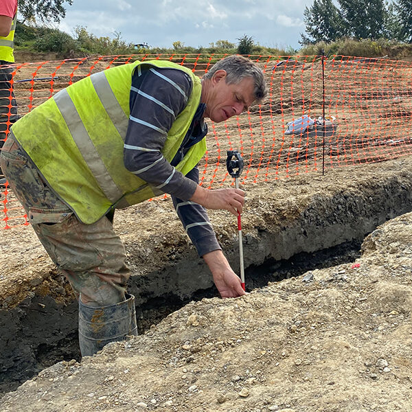
Work begins on the palaeochannel
Rinsing rocks
Get out your wet sieve and waders.
Peeling back the layers
The team digs deeper
The main trench
The heart of the mammoth graveyard
A mammoth emerges
An in-situ mammoth ulna
More fragmentary remains
A mammoth vertebrae
Evidence of Neanderthals
A humble flint with a big story
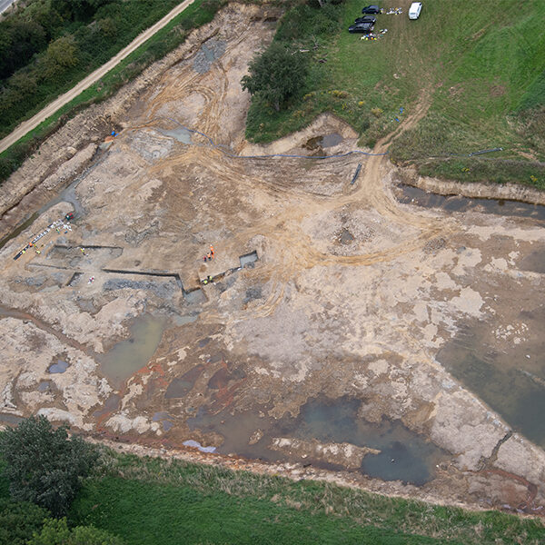
A birds-eye view An aerial shot of our excavation area
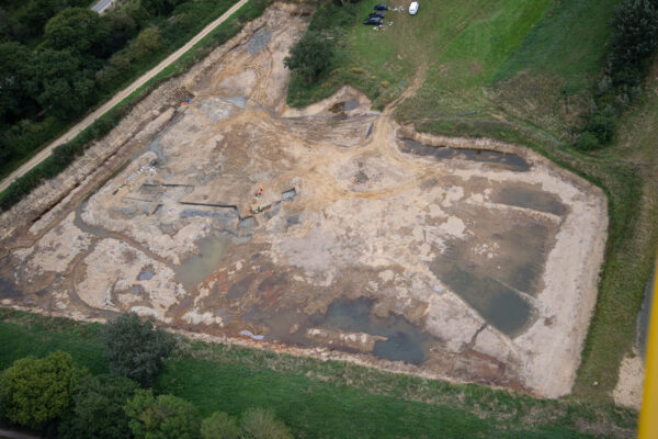
This is an aerial view of our excavation area. The image shows the trenches on the left hand side of the quarry, as well as pools of water. This entire quarry was flooded prior to the start of the excavation. Water management became a key part of successfully completing the dig, and required constant monitoring to ensure the area did not become resubmerged while the excavation was ongoing.
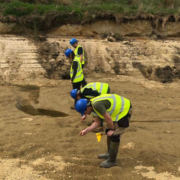
Eyes on the ground Pre-excavation fieldwalking
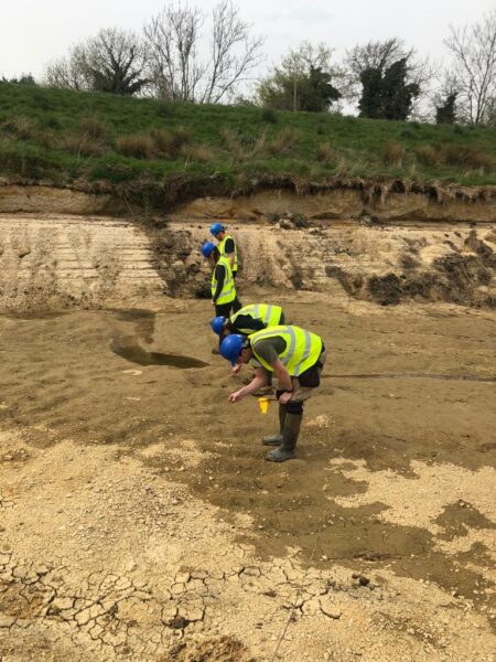
Once the quarry was drained, an extensive period of fieldwalking began. Working in 10m x 10m grids, the team carefully traversed the quarry looking for worked flint and faunal remains. Each find was carefully logged with a GPS and flagged for later investigation. This fieldwalking helped inform the team as to where to locate trenches for the next phase of investigation.
Locating an ancient river Work begins on the palaeochannel
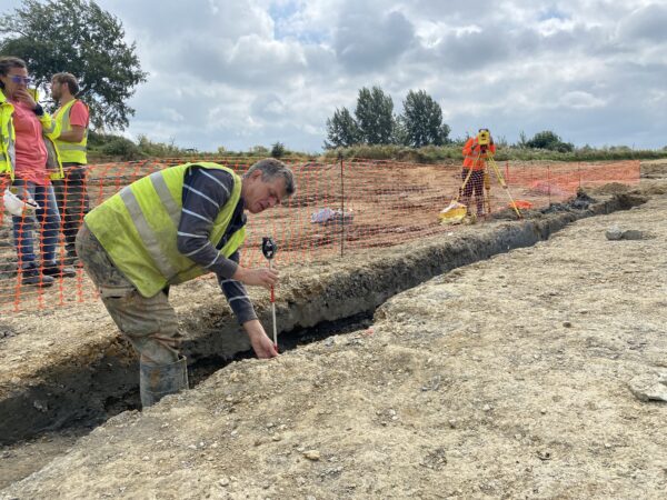
A team of geoarchaeologists from the University of Winchester worked to identify the path of the palaeochannel which once meandered through the landscape. Palaeochannels are ancient, extinct waterways which are an excellent place to focus an excavation. Through all periods of time, bodies of water attract both humans and animals alike, and can often be a great source of archaeological finds and environmental insight.
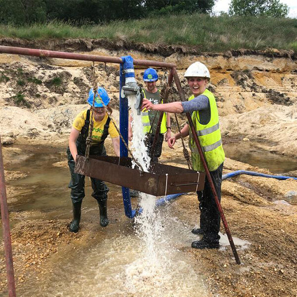
Rinsing rocks Get out your wet sieve and waders.
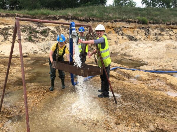
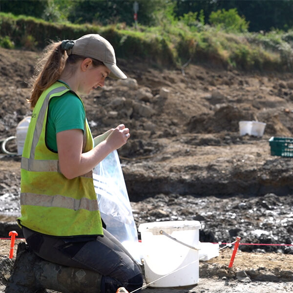
As the excavations began on site, the team made sure to carefully wet sieve every shovelful of sediment removed from the trenches. Working in a water-logged, muddy quarry means that identifying human-worked flint from naturally occuring flint is made all the more difficult when it’s covered in a brown, silty clay film. Each bucket of spoil was carefully washed on a sieve lined with stiff mesh and thoroughly checked over for worked flint. Luckily, there was no shortage of available water.
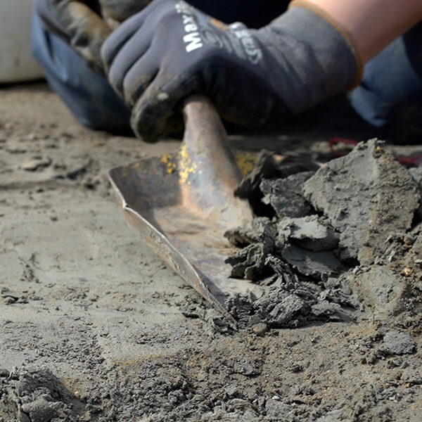
Peeling back the layers The team digs deeper
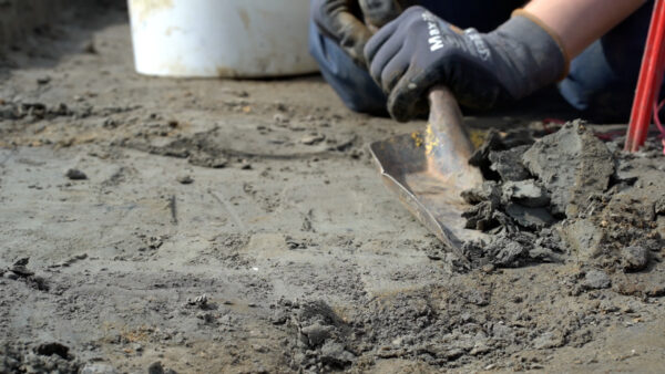
Once the layers of gravel were removed, the team began to excavate the sandy layer beneath. The geoarchaeologists determined that this sand formed the bank of the ancient river. Centimetre by centimetre, layers of sand were removed, paying close attention to any flint, fossils or plant remains uncovered along the way. All of the excavated sediment was collected in buckets and put through a fine-mesh wet sieve to catch small fragments of worked flint and palaeoenvironmental samples.
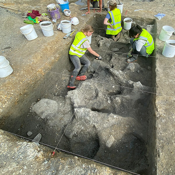
The main trench The heart of the mammoth graveyard
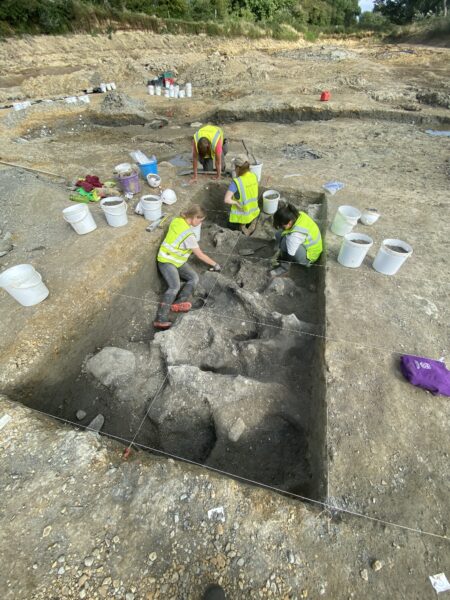
The team worked in 1m x 1m grids to carefully excvate the bank of the palaeochannel. With no features like post holes or ditches, the entire open excavating area required careful examination. Here, you can see the undulating clay of the river bed, shaped by the water which once flowed through this area. You can also see the sample buckets full of excavated sediment on the trench edge ready for processing, and the wet sieve in the background. The samples were analysed for seeds, shells and insects to better understand the environment and climate over 200,000 years ago.
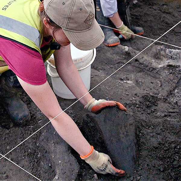
A mammoth emerges An in-situ mammoth ulna
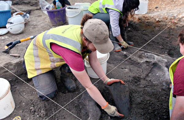
Within one of our grids on the bank of the palaeochannel, we uncovered a disarticulated mammoth ulna. This fragmentary right ulna weighs over 5kg, and would have belonged to an adult mammoth measuring approximately 4m tall at the shoulder. Preliminary analysis suggests this find may show evidence of butchery or animal gnawing, providing vital clues to understanding how mammoths and Neanderthals interacted in this landscape. However, further research is needed to confirm these findings.
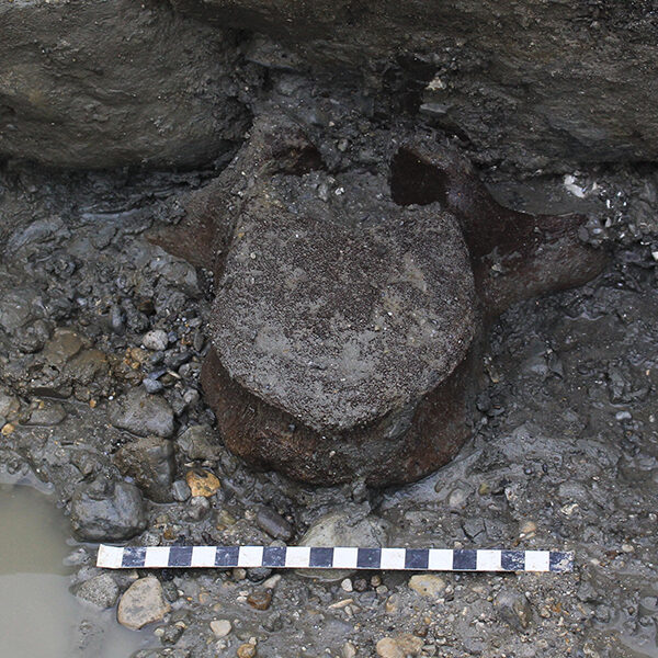
More fragmentary remains A mammoth vertebrae
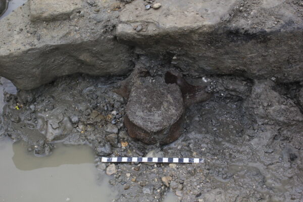
This thoratic vertebra was nearly complete when found. It measures just shy of 20cm across, is unfused, and has been identified as belonging to a juvenile mammoth – under the age of 18-19 when it died.
Evidence of Neanderthals A humble flint with a big story
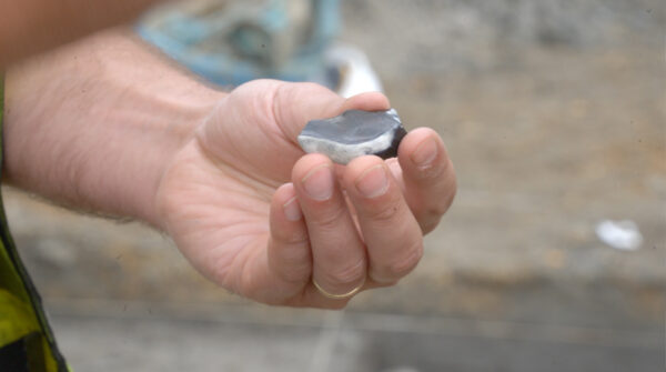
This flint scraping tool fits perfectly between a thumb and a forefinger and is even more evidence that there was human activity at the site. Measuring approximately 4cm long by 3cm wide, a small tool like this would probably have been used for scraping hides which could then be used for clothing or shelter. This tool was collected from a grid less than 1m away from the mammoth ulna, suggesting that perhaps early humans and mammoths were indeed interacting on this site.
Virtually step into the trenches with these 3D models
Test Pit 1 - 2019
Learn more +Lower Palaeolithic handaxe
Learn more +Test Pit 3 - 2019
Learn more +Continue through the exhibition
There's plenty more to explore...