Coastal Archaeology Under Climate Threat: Purbeck and Studland
- Area size: 35 km2
- Project partner: National Trust
- Launch date: 4 September 2023
Parts of Dorset’s Jurassic Coast are disappearing. Coastal erosion is reshaping the shoreline faster than traditional surveying can keep pace with. And at £1,000 per hectare, conventional survey methods were simply too expensive to cover the scale the National Trust required.
From 1,040 applicants across 31 countries, 743 participants (known as Pastronauts) completed their training, and got to work, mapping heritage features from satellite imagery and LiDAR data. This became Deep Time’s most international mission, with a genuinely global community coming together around one vulnerable stretch of English coastline.

The Landscape
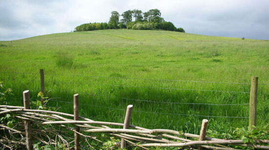
Purbeck and Studland occupy one of the most geologically dramatic stretches of the English coast, as limestone cliffs give way to lowland heath and chalk grassland, and Studland’s beaches curve toward the mouth of Poole Harbour. The landscape is layered with human history, from Iron Age hillforts to medieval Corfe Castle, with wartime defences and ancient field systems now crumbling at the cliff edge.
This coastline is changing fast, with rising sea levels and accelerating erosion reshaping the shoreline in ways that are difficult to track, and impossible to reverse. What our Pastronauts mapped here isn’t just a record of what exists, but rather a record of what the sea will eventually claim.
Project Map
Our interactive map cannot be used on small screens. Please use a desktop, laptop or large tablet (such as an iPad) to view it.
See all the archaeology digs, talks, festivals and other events coming up at DigVentures
Learn more about digging up the past and have fun while you're doing it!
We're connecting people who love archaeology, with opportunities to do archaeology.
Find projects you can be part of or follow all the archaeological action with our Live Updates ›
Archaeology experiences and other perfect presents for people who love the past.

