Heritage and Peatland Recovery: Peak District
Protecting archaeology beneath 10,000 hectares of damaged peatland as the National Trust repairs a vital carbon sink.
- Area size: 123 km2
- Project partner: National Trust
- Launch date: 13 November 2023
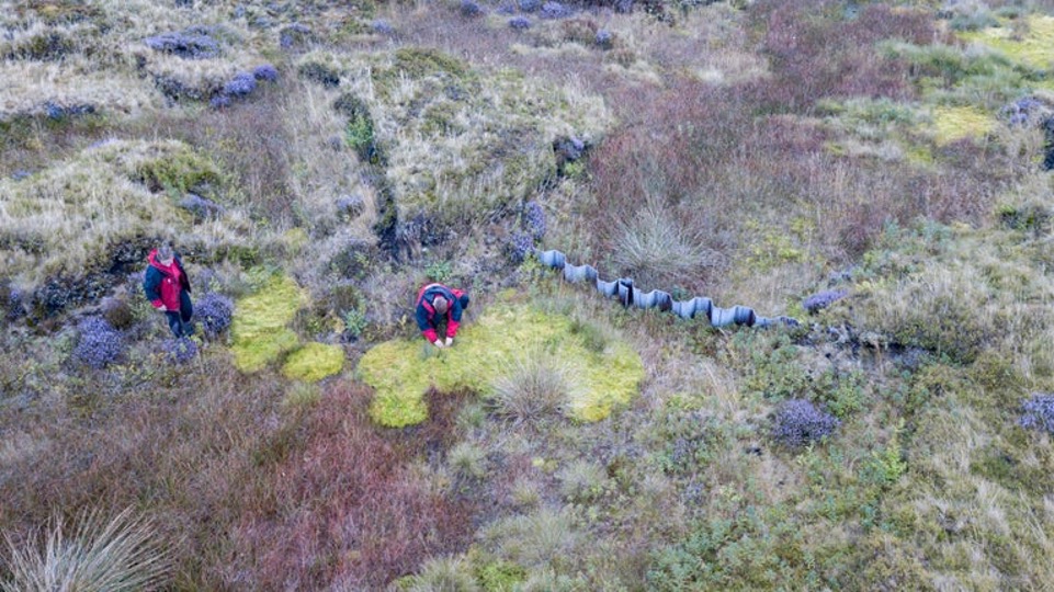
The National Trust is working to restore 10,000 hectares of damaged peatland in the Peak District, gradually bringing landscapes that release carbon back into the functioning “carbon sinks” they should be, rather than carbon sources. But before that restoration work could begin across 123 km², they needed to understand what was hidden below.
Our participants (known as Pastronauts) used LiDAR and satellite imagery to map what was there, giving the Trust the knowledge they needed to restore the landscape, without losing the archaeology it had protected for centuries.
The Landscape
The Peak District’s high moorlands are among the most important peatland landscapes in England. Formed over thousands of years, these deep peat deposits store vast quantities of carbon and support distinctive upland ecology. But centuries of drainage, overgrazing and atmospheric pollution have left much of this peatland damaged, drying out, eroding and releasing carbon, rather than capturing it.
Beneath the peat lies a rich archaeological record of prehistoric communities that lived and worked across these uplands, leaving traces that are invisible from the surface, but revealed in stunning detail by LiDAR. Understanding where these features sit is essential, not just for heritage protection, but because archaeological remains can influence how peatland restoration is designed and where it can safely proceed.
Project Map
Our interactive map cannot be used on small screens. Please use a desktop, laptop or large tablet (such as an iPad) to view it.
See all the archaeology digs, talks, festivals and other events coming up at DigVentures
Learn more about digging up the past and have fun while you're doing it!
We're connecting people who love archaeology, with opportunities to do archaeology.
Find projects you can be part of or follow all the archaeological action with our Live Updates ›
Archaeology experiences and other perfect presents for people who love the past.

