Cultural Heritage and Landscape Intelligence – Hadrian’s Wall
Mapping the archaeology that shapes a living landscape
- Area size: 1,631 km2
- Launch date: 16 June 2026
In 2025-2026, we ran a mission to investigate the habits and natural heritage of Hadrian’s Wall. Our Futurenauts mapped more than 32,414 habitat polygons, representing 16 habitat types, across 1,631 km² of the Hadrian’s Wall corridor. Now, we’re recruiting a new cohort of Pastronaut to map the archaeological features across the same area, so we can examine the two datasets side by side.
The long history of land use is part of what makes this corridor such a compelling place to study. Some of the habitats have roots in how the land was managed in the past, such as a medieval field boundary that became a hedgerow, a disused drove road that now supports rare plants, a pond that was drained a century ago but still holds a seed bank. There are likely to be many more connections between the historic environment and the natural landscape we see today, and this mission is designed to help us understand them more fully. This is the first time a dataset this complete will have been compiled for Hadrian’s Wall – and you can help us do it!
After working as an environmental consultant for over 30 years I can appreciate the power of citizen science. I think that the Deep Time approach could form a valuable part of initial data gathering and subsequent monitoring of land use changes – David, Futurenaut
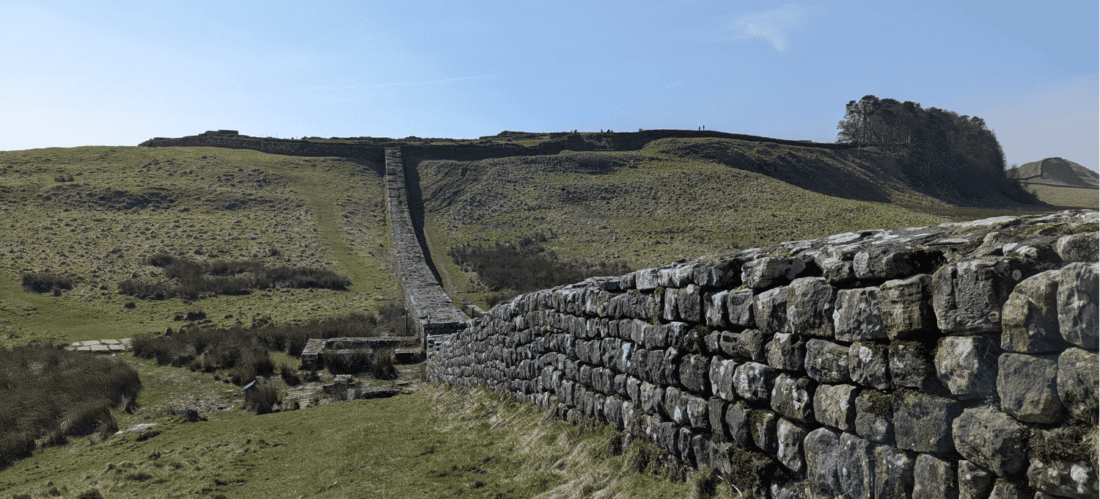
The Landscape
As one of the most significant Roman monuments in the world and a UNESCO World Heritage Site, Hadrian’s Wall itself tends to dominate any description of this landscape. The corridor it runs through is remarkable in its own right for reasons that go well beyond the Wall itself, and that’s what this mission is designed to bring to life.
The mission study area stretches from the Northumberland coast in the east to the Cumbrian border in the west, taking in river valleys, exposed moorland, ancient woodland fragments, and some of the most species-rich grassland in northern England. It is also a landscape with a long and layered human history including thousands of years of farming, land management, settlement and movement that have influenced what grows there today.
Some historic features have a clear ecological significance: former field boundaries that now support hedgerow species, old routeways that have become sheltered corridors for specialist plants and invertebrates, others have little obvious relationship with the habitats around them when examined in isolation. This mission aims to explore these potential relationships by collecting data that will allow the relationship between the archaeological and natural landscape to be examined in greater detail.
Take Part
You need to be logged in to start this mission.
See all the archaeology digs, talks, festivals and other events coming up at DigVentures
Learn more about digging up the past and have fun while you're doing it!
We're connecting people who love archaeology, with opportunities to do archaeology.
Find projects you can be part of or follow all the archaeological action with our Live Updates ›
Archaeology experiences and other perfect presents for people who love the past.

