Reference

DIGtionary

Definitions for common and not-so-common archaeological terms that you might encounter on your mission.


A - F

Ard

An early type of plough that broke up soil by pushing it rather than turning it over.

Artefact

An object that has been made or modified by humans or human ancestors.  

Ballast

In relation to railways this refers to gravel or substrate that is used on top of a rail bed to facilitate drainage and keep rails clear of vegetation. 

Cairn

A pile of stones raised for a purpose, usually as a marker of some type.

Colliery

A coal mine and its associated buildings and equipment.

Cursus monument

A long and narrow earthwork enclosure usually with exterior ditch.

Deer leap

A low place in a park pale or fence with a wide interior ditch allowing a deer entry into a park but not exit.

Dyke

A linear earthwork consisting of a ditch and at least one flanking bank, usually marking a land boundary.

Embankment

A wall or bank of earth or stone used particularly to hold back water or to carry a railway.

First Return (LiDAR)

The measurement that comes from the first object the LiDAR laser beam hit.

Fulling

The process of beating woven woollen cloth while wet to cause the fibres to interlock and form a denser and firmer textile.

Furlong

The name for a field in open system farming (“furrow-long”)


G - K

Hectare

(abbreviated ha) A unit of measurement of land. Equivalent to 10,000 square metres.

Inhumation

The burial of a body.


L - P

Leat

An artificial channel dug for water management, especially with relation to water mills.

Lynchet

A terrace or ridge formed by the act of ploughing a hillside over time.

Map Regression

Comparing maps of different periods in order to understand change or locate features.

Metadata

Data that describes other data. The text information you create to describe the polygons you draw is metadata.

Metalled Road

A road that is surfaced with aggregate or stone.

Monument

Refers to the documentation of any feature of the landscape or seascape that, by its nature (either extant or former), imparts knowledge about the historic environment. (Includes Find-spots)

This means the official definition of Monument can refer to physical remains, or it can indicate something that is known to have existed through historical documents or records but is no longer present.

In Deep Time, when we refer to Monuments we are talking about existing remains, and particularly focusing on ones that are visible through LiDAR.

Multivallate

Having more than one raised wall or earthwork surrounding an enclosure.

Orthostat (plural orthostats)

An upright stone or slab.

Palaeoenvironmental

Relating to the environment at a point in the geological past.

Palisade

A fence of wooden stakes set into the ground forming an enclosure or defensive feature.

Pennanular

Having the form of a circle with a break in it.

Pit alignment

A boundary earthwork composed of a linear series of pits, often accompanying a bank.

Plateway

A type of railway for animal drawn vehicles where the tracks are plated with or made of cast iron.


Q - U

Rampart

A wall or embankment built around a structure or settlement as protection.

Raster data

Raster data is arranged in a virtual grid with rows and columns made up of small ‘cells’ – or what you would know as a pixel. This can be thought of a similar to a photo.

Reave

A long straight boundary wall made of or topped with stone used to divide fields in the (bronze age).

Remote Sensing

Collecting information about places at or under the ground surface without actually having to disturb the ground.

Revetment

The fortification of a wall. It can be either a separate structure or an added facing. May also refer to a protective earth barricade.

Site

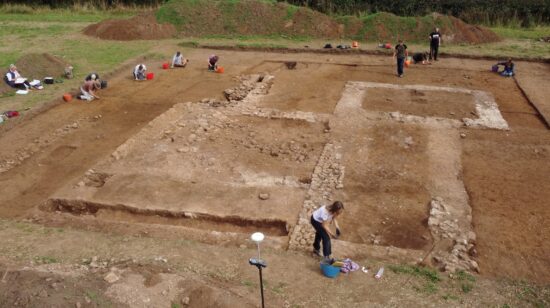
A broad term that is used for a variety of purposes, it can mean a place where an excavation is happening, a place where there are visible archaeological remains and of course can be used for its non-archaeologically specific meaning of – the place where something is or will be located.

Sleeper

Relating to the railway, a support piece that rails are attached to in order maintain proper gauge, reduce vibration and spread load evenly.

Sluice gate

A barrier used for controlling water flow.

Spoil

Soil resulting from excavation.

Swathe (LiDAR)

The width of land that the LiDAR laser can scan in one pass.

Transect

A straight line through a feature or across the earth’s surface, along which observations are made or measurements taken.

Tumulus

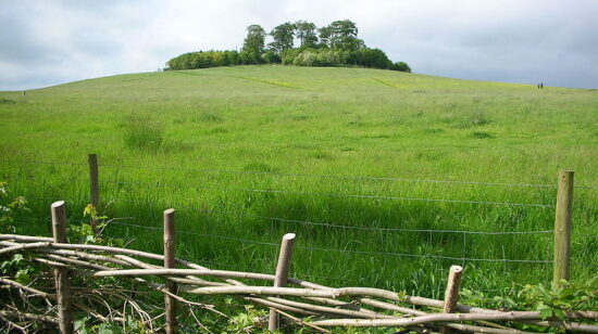
A barrow or burial mound. The term comes from the Latin word meaning mound or hill.

Univallate

Having a single raised wall or mound surrounding an enclosure.


V - Z

Vector data

Vector data is not based on pixels or a grid, but individual points that have spatial coordinates. Points can be used individually or be related to each other to create lines or shapes called polygons. Vector data is generally used for handling information like the dimensions of an area or the length of a feature on the landscape.

Archaeology / In Your Hands
  • Heritage Lottery Fund
  • CIfA

See all the archaeology digs, talks, festivals and other events coming up at DigVentures

Learn more about digging up the past and have fun while you're doing it!

We're connecting people who love archaeology, with opportunities to do archaeology.

Archaeology experiences and other perfect presents for people who love the past.