Caerfai Camp, the ancient fort under threat from climate change
Wherever you go, you can be sure that someone else was there hundreds or thousands of years before you. There are incredible ancient places hiding all around us. Let’s go find them!
The gorgeous, windswept coastline of St David’s peninsula in Pembrokeshire, Wales, is lined by the Pembrokshire Coastal Path, which draws in rugged, windswept walkers for plenty of reasons; dramatic natural beauty, sheer cliffs, and pristine coves hugged by white sand beaches.
For history-lovers, however, all this scenery is the breathtaking backdrop to something even more profound; a string of 12 ancient coastal forts which line these dramatic cliffs. Marked by huge earthen banks, and rings of unnatural-looking defences, their construction dates back to prehistoric times.
Among the most impressive is Caerfai Camp, known as Penpleidiau in Welsh. Beyond the stunning views, its sheer size, and enduring air of mystery, there’s something else quite striking about this site: it’s at risk of falling into the sea.
Today, you can still see its main defensive banks, which still stand up to 3.5m tall, and unlike most of its smaller companions which are defended by just one or two rows of earthworks, the entrance to Caerfai is defended by four semi-circular banks radiating outwards.
Make it past these enormous banks, and the next thing you’ll face is a hair-raising walk across a narrow strip of land which brings you to a promontory that is almost entirely separated from the mainland by a chasm.
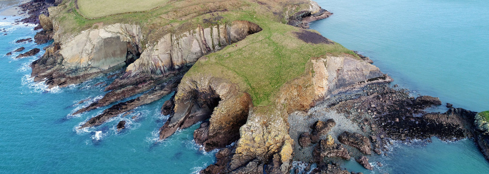
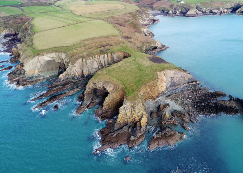
Aerial view of Caerfai Promontory Fort (CHERISH Project)
The fort is located on a promontory that is barely clinging onto the mainland
Caerfai's defensive earthworks are impressive, standing up to 3.5m tall from top to bottom
The views over Caerfai Bay might tempt you for a swim
St Davids Peninsula is filled with great walks, and prehistoric monuments. Enjoy!
Once you cross the landbridge, you enter the interior of the cliff-girt fort. Measuring aprroximately 100m x 50m, it is naturally defended by cliffs on the south, west, and eastern sides, and shows signs of having enclosed a series of circular structures. At the foot of the cliffs, is a good natural, small-boat harbour to the south and the gorgeous white-sand beach of Caerfai Bay.
All in all, it is one heck of a place, but the date of the site is as yet unknown.
It’s thought that it was first constructed during prehistoric times and used by past people as a place refuge in times of need, but in reality little else is known – except for the devastating impact that coastal erosion is having on the remains, and others along the Welsh coastline.
Who built it? Why? How did they use it? And of course, WHEN?
DigVentures will be leading the very first excavation of the site in September 2021, in partnership with CHERISH Project, Pembrokeshire Coast National Park, the National Trust and Cadw to find out.
A large part of the fort’s interior has already been lost to coastal erosion and continues to be affected by climate change and sea level rise. Building on four years of survey, drone photogrammetry, and geophysical survey by the CHERISH Project, the dig will bring together local residents, archaeology enthusiasts, and professional archaeologists in an epic attempt to recover as much information about the site – before it’s too late.
Visiting Caerfai Camp
Caerfai Camp is a short walk from the Pembrokeshire Coastal Path. During the dig, you’ll be able to walk along the coastal path as usual.